
Wildgoose Colour Blind Friendly UK Political Map
Product Code: HP00059733
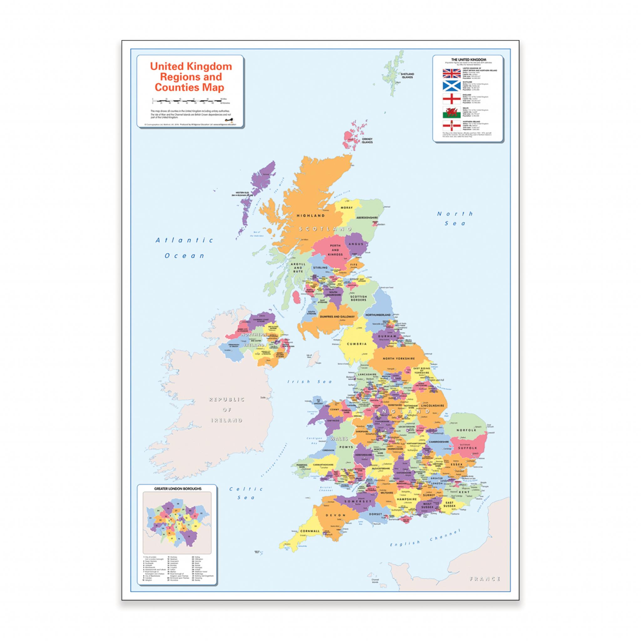
Teach or learn about the United Kingdom with this colourful, easy to read children's world map showing the countries, counties, major cities and towns.
The map also includes the surrounding ocean and seas,
Flags and information on the countries and a close up insert of the Greater London boroughs.
It is ideal for the home or classroom as our colours work for everyone, including those with a form of colour vision deficiency (CVD).
There is likely to be at least one child in every classroom that is colour blind
Category
Maps & Compasses
Specifications
Brand
Own Brand
Categories
Geography
Category
Maps & Compasses
